The Story
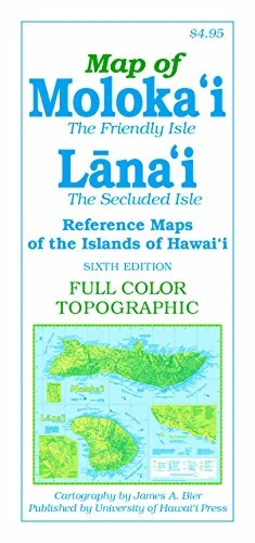
Features of the sixth edition of this full-color, topographic map of the Friendly Isle include detailed road networks, large-scale inset maps of towns, points of interest (historic, natural and cultural), hiking trails, parks, beaches, waterfalls, peaks and ridges (with altitudes), and more than 700 place names (index included). Most notably, Hawaiian words are spelled with all accent marks.
21 x 18 inches (unfolded), color
Description
Features of the sixth edition of this full-color, topographic map of the Friendly Isle include detailed road networks, large-scale inset maps of towns, points of interest (historic, natural and cultural), hiking trails, parks, beaches, waterfalls, peaks and ridges (with altitudes), and more than 700 place names (index included). Most notably, Hawaiian words are spelled with all accent marks.
21 x 18 inches (unfolded), color